
Water mills at the island
Article Index
B) THE LEFT BRANCH
The oldest traces of the Tiber mills are found on the left branch of the river; it was, however, less used than the right one due to its reduced water flow.
 The first textual references to the mills are found in texts of the 1300s, but the first graphic evidence is a drawing by "Anonymous Escurialensis" (after a drawing by Giuliano da Sangallo), dated between 1485 and 1514 (pict. B1), that shows three mills on the Tiber's left branch just upstream from the Ponte Fabricio, and an engraving by Hieronymus Cock dated 1530-34 (pict. B2) that shows two mills, also just upstream from the Fabricio bridge, one anchored to the left bank and the other to the island.
All later images show a single mill, or two placed side by side, but located upstream, on the Regola bank.
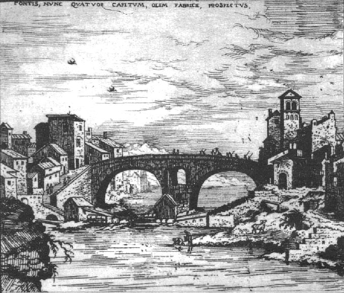
 In particular two mills are shown by Silvestro Peruzzi (1564-65) and by Giovanni Maggi (1625) (pict. B3); Maggi drew them not to scale and located in front of S.Vincenzo and Anastasio at the Regola, further upstream than where they probably really were.
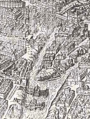
A single mill is indicated in the maps of Antonio Tempesta (1593), Matteo Greuter (1618), G.B.Falda (1676) (pict. B4) and G.B.Nolli (1748) (pict. B5).
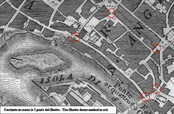
This mill is known (1620) as "mola di S.Andrea al Portone delli Hebrei" [mill of S.Andrea at the Door of the Jews], as it was located near one of the 5 doors, clearly visible in the Falda and Nolli maps, that enclosed the Jewish Ghetto constituted by Papal Bull in 1555. The doors were definitively unhinged only in 1848.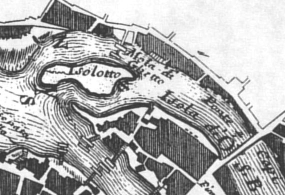
Andrea Chiesa, engineer from Bologna, appointed together with Gambarini to study the Tiber, also reported in 1745 that in the left branch of the river near the island there was only one mill, known as "Mola di Ghetto" [mill of the Ghetto], located in correspondence with the north end of the island and therefore near Monte Cenci as shown in the 1746 map (pict. B6).
The last citation of this mill is dated 1810; the mill, therefore, completely disappeared in the beginning of the 1800s.
 The last known mill on the Tiber's left branch is the so-called "mola terragna" [mill with foundations] located on the island (not floating). In a census it was numbered as 43 and 44 of "Via delle mole di S.Bartolomeo" [Street of the Mills of St Bartolomeo]. Starting in 1826 it is found, under the name of the "Giuditta" mill, in the records of the "Specchi Dimostrativi" [Demonstrative Reports] of grinding (see also para. D). Its location is shown on the Lanciani map (end of XIX century - pict. B7) together with the long wall of pilings which directs the flow of the water to the mill.
